
Macau Geography: Peninsulas, Islands, and Land Reclamation
The Macao Special Administrative Region (SAR) possesses a unique geographical layout characterized by a blend of natural formations and extensive human engineering. Its landscape is defined by a primary peninsula, a main island, and a collection of smaller islets, peninsulas, and artificial landmasses.
Key Facts
- Composition: Consists of one main peninsula, one main island, and several smaller islets and artificial islands.
- Primary Location: Situated near the Pearl River (Zhujiang) in Guangdong Province, China.
- Major Landmasses: Includes the Macau Peninsula, Taipa, and Coloane.
- Key Transformation: The creation of the unnamed main island via the Cotai reclamation project.
The Macau Peninsula
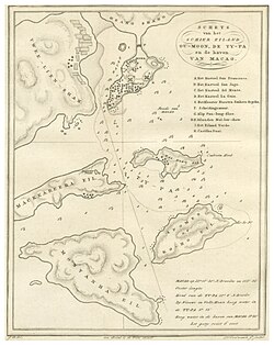
The Macau Peninsula serves as one of the region's primary hubs. Interestingly, it was not always a peninsula; it was originally an island within the Pearl River Delta. Over approximately two thousand years, natural sedimentation—the process of particles settling out of the water—linked it to Zhongshan Island, transforming it into its current peninsular form.
Islands and Artificial Landmasses
To the south of the Macau Peninsula lies the region's main island. This landmass is positioned to the east of Hengqin Island in the Pearl River. Unlike the peninsula, this main island is a product of modern engineering.
The Cotai Reclamation
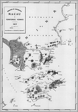
In the late 1990s, a massive land reclamation project known as Cotai was undertaken. This project filled the channel that previously separated the islands of Taipa and Coloane. As a result, these two islands were merged into a single, larger landmass. This newly created main island remains unnamed.
Historical Administration
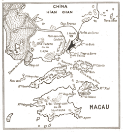
Historically, the islands of Coloane and Taipa were managed under a specific administrative body called the Concelho das Ilhas. This administrative entity was eventually abolished in 2001.
Land Evolution and Connectivity
The geography of Macau is a testament to the impact of both natural and artificial changes. While the Macau Peninsula was formed through natural sedimentation, almost all other former islands in the region have been merged. These mergers occurred either directly or indirectly with the Macau Peninsula or the unnamed main island through artificial land reclamation.
| Feature | Type | Origin/Formation |
|---|---|---|
| Macau Peninsula | Peninsula | Natural sedimentation (formerly an island) |
| Main Island | Island | Artificial (Cotai reclamation of Taipa and Coloane) |
| Taipa & Coloane | Former Islands | Merged into the main island via reclamation |
| Hengqin Island | Island | Natural (located west of the main island) |
Frequently Asked Questions
Was the Macau Peninsula always connected to the mainland?
No, the Macau Peninsula was originally an island in the Pearl River Delta. It became a peninsula roughly two thousand years ago due to natural sedimentation linking it to Zhongshan Island.
What is the unnamed main island in Macau?
The unnamed main island was created in the late 1990s through the Cotai reclamation project, which filled the channel between the islands of Taipa and Coloane.
What happened to the Concelho das Ilhas?
The Concelho das Ilhas was the administrative body responsible for Coloane and Taipa; it was abolished in 2001.
How have Macau's islands changed over time?
Most of Macau's former islands have been merged with either the Macau Peninsula or the newly created main island through artificial land reclamation projects.