
Mercury Bay: A Historic Coastal Gem of the Coromandel Peninsula
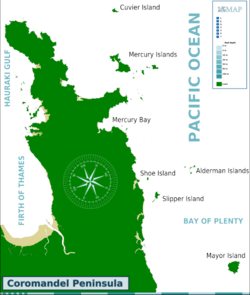
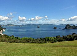
Located on the eastern coast of the Coromandel Peninsula in New Zealand's North Island, Mercury Bay is a striking V-shaped bay known for its rich maritime history and stunning natural beauty. Originally named Te-Whanganui-a-Hei (the great bay of Hei) by the Māori, the area later became known by its English name following the exploratory expeditions of Captain James Cook.
Key Facts
- Original Name: Te-Whanganui-a-Hei.
- Dimensions: Mouth is approximately 10 km wide with a 20 km coastline.
- Key Town: Whitianga, featuring a natural harbour extending 6 km inland.
- Historical Event: Site of Captain Cook's 1769 observation of the Transit of Mercury.
- Marine Protection: Home to the Whanganui A Hei (Cathedral Cove) Marine Reserve.
Maritime History and Exploration
The bay's English name is tied to a specific scientific event. On November 9, 1769, Captain James Cook landed here to observe a Transit of Mercury—an astronomical phenomenon where the planet Mercury passes directly between the Sun and Earth.
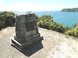
For many years, a memorial at Shakespeare Cliff was believed to mark the spot of these observations. However, it was later discovered that this location was erroneous. The actual site of Cook's landing and observation was at the eastern end of Cook's Beach, near the Purangi estuary, where a smaller memorial plinth now stands.
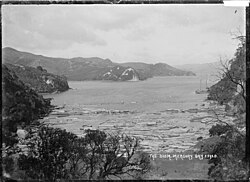
The bay has also witnessed more turbulent times. On August 20, 1815, the schooner Brothers and the brig Trial were attacked by Māori, resulting in the deaths of several sailors. Additionally, the bay serves as the final resting place of the HMS Buffalo, a ship used to transport prisoners and passengers to Australia, which was wrecked during a storm in 1840.
Geography and Natural Landmarks
Mercury Bay is characterized by its expansive coastline and diverse landmarks. To the north, the Mercury Islands sit approximately 10 km away, while several smaller islets dot the northern and southern extremities of the bay. The southern region is particularly noted for the Whanganui A Hei (Cathedral Cove) Marine Reserve, a protected area of high ecological value.
Notable locations along the bay include:
- Buffalo Beach and Wharekaho
- Ferry Landing and Shakespeare Cliff
- Lonely Bay and Flaxmill Bay
- Cooks Beach and Purangi Estuary
- Cathedral Cove and Hahei
The Lost Arch
Historical records from the 1700s, including illustrations from Cook's ship, the Endeavour, depict an arched rock formation in the bay. This formation, which once featured a pā (a Māori fortified village) on top, has since collapsed.
Modern Recreation and Sport
Today, Mercury Bay is a premier destination for water sports. It is renowned for yachting and game fishing, boasting the Mercury Bay Game Fishing Club, one of the largest of its kind in New Zealand. The town of Whitianga is a central hub for these activities; its Mercury Bay Boating Club notably served as the challenging club for New Zealand's first America's Cup challenge in 1987.
| Feature | Detail |
|---|---|
| Mouth Width | ~10 km |
| Coastline Length | ~20 km |
| Primary Settlement | Whitianga |
| Key Marine Reserve | Whanganui A Hei (Cathedral Cove) |
| Notable Shipwreck | HMS Buffalo (1840) |
Frequently Asked Questions
Why is it called Mercury Bay?
It was named by Captain James Cook, who landed there in November 1769 to observe the Transit of Mercury.
Where is the correct memorial for Captain Cook's observation?
While a memorial exists at Shakespeare Cliff, the actual site of the observation was at the eastern end of Cook's Beach near the Purangi estuary, where a smaller plinth is located.
What is the original Māori name for the bay?
The bay was originally named Te-Whanganui-a-Hei, which translates to the great bay of Hei.
What is the significance of the Mercury Bay Boating Club?
The club is based in Whitianga and was the challenging club for New Zealand's first America's Cup challenge in 1987.
What happened to the arched rock formation mentioned in historical texts?
The arched rock, which was illustrated aboard the Endeavour and featured a pā on top, has since collapsed.