
National Route 7: Argentina's Vital Link from Buenos Aires to the Andes
National Route 7, officially known as Ruta Nacional 7 Carretera Libertador General San Martín, is one of Argentina's most critical transport arteries. Stretching across the heart of the country, this road serves as a primary link between the Atlantic coast and the Andes mountains, connecting the capital city of Buenos Aires with the border of Chile.
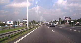
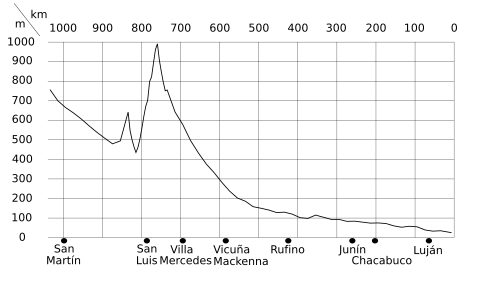
Spanning a total length of 1,224 kilometers (761 miles), the route traverses five provinces: Buenos Aires, Santa Fe, Córdoba, San Luis, and Mendoza. To accommodate heavy traffic and improve safety, approximately 30% of the route (367 km) has been developed as freeways.
Key Facts
- Total Length: 1,224 km (761 mi).
- Route: From Buenos Aires City to Paso Internacional Los Libertadores (Chilean border).
- Provinces Crossed: Buenos Aires, Santa Fe, Córdoba, San Luis, and Mendoza.
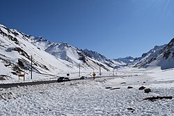
- Infrastructure: Includes 14 tunnels and the massive Túnel del Cristo Redentor.
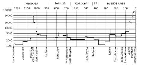
- Highest Traffic: The easternmost 10 km near Buenos Aires, recording 82,500 vehicles per day in 2001.
Historical Development and Evolution
The modernization of Route 7 occurred in stages over several decades. Paving began in earnest in the early 1940s, with the section between Chacabuco and Junín completed in June 1942. By October 1969, significant stretches between Rufino and Laboulaye were opened to speed up regional transport. The paving process reached Villa Mercedes in 1975, creating a vital junction with National Route 8.
In the late 1970s, the focus shifted to upgrading the road into a highway between San Martín and Mendoza. This included the construction of a new bridge over the Mendoza River. During this period, several sections were transferred to provincial jurisdiction, becoming Provincial Route 52 and Provincial Route 82.
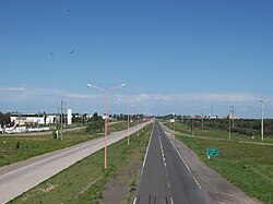
A notable modern addition is the Autopista de las Serranías Puntanas in San Luis Province. Funded by the province and opened in April 2003, this 212 km expressway is distinguished by having lighting along its entire length.
Regional Highlights and Geography
The Santa Fe Section and La Picasa
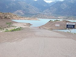
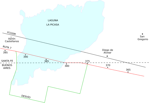
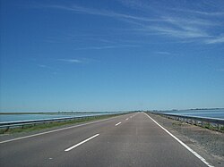
The route encountered a significant geographical challenge between 1998 and 1999 when the growth of Laguna La Picasa flooded 14.5 km of the road. This necessitated a rerouting project, with the new 10.5 km section finally opening to traffic in June 2007.
Traversing the Provinces
Route 7 serves as a lifeline for numerous cities and departments across Argentina:
- Buenos Aires: Passes through Morón, Ituzaingó, Moreno, Luján, and Junín.
- Santa Fe: Crosses the General López Department, including Rufino.
- Córdoba: Links Laboulaye and Vicuña Mackenna.
- San Luis: Runs for 221 km, passing through Villa Mercedes and the provincial capital, San Luis.
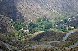
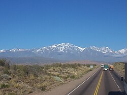
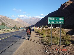
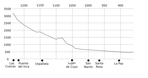
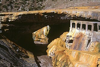
- Mendoza: Covers 372 km, leading through Santa Rosa, San Martín, and the high-altitude tourist sites of Uspallata and Puente del Inca.
Engineering and Road Conditions
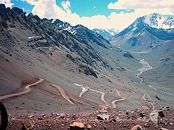
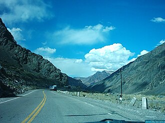
As the route ascends into the Andes in Mendoza Province, the engineering becomes increasingly complex. The road features a series of tunnels to navigate the mountainous terrain, culminating in the 3,080-meter Túnel del Cristo Redentor at the border.
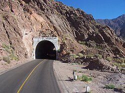
| Structure Name | Location (km) | Length (m) |
|---|---|---|
| Tunnel n.º 8 | 1130.32 | 150 |
| Tunnel n.º 9 | 1132.31 | 210 |
| Tunnel n.º 10 | 1132.62 | 190 |
| Tunnel n.º 14 | 1232.04 | 440 |
| Túnel del Cristo Redentor | 1235.39 | 3080 |
Management and Traffic
Management of the route has transitioned through various concession models. In 1990, high-traffic roads were divided into "Road Corridors." Companies such as New Routes and Caminos del Oeste managed different segments, installing tollbooths at strategic points like Villa Espil, Junín, and La Paz.
Traffic volume is heavily skewed toward the east. While the section near Buenos Aires sees tens of thousands of vehicles daily, volume drops significantly in rural areas and high-altitude mountain passes.
Frequently Asked Questions
Where does National Route 7 begin and end?
It begins at the Buenos Aires City limits (junction with RN A001 and 25 de Mayo Highway) and ends at the Paso Internacional Los Libertadores on the border with Chile.
Which provinces does the route cross?
The highway crosses five Argentine provinces: Buenos Aires, Santa Fe, Córdoba, San Luis, and Mendoza.
What is the Autopista de las Serranías Puntanas?
It is a 212 km expressway in San Luis Province, opened in 2003, which is notable for being illuminated along its entire length.
How did Laguna La Picasa affect the road?
Between 1998 and 1999, the lake expanded and flooded 14.5 km of the road, forcing a reroute that was eventually completed in 2007.
What is the longest tunnel on Route 7?
The longest is the Túnel del Cristo Redentor, measuring 3,080 meters in length.