
Copenhagen Public Transportation
Copenhagen boasts one of the most integrated and efficient public transit networks in the world. By seamlessly combining a driverless metro, an expansive suburban rail system, regional trains, and a diverse bus fleet, the city ensures that residents and visitors can navigate the capital and its surrounding regions with ease.
Key Facts
- Metro: A 20.5 km driverless system with four active lines (M1-M4) and a fifth (M5) planned.
- S-train: An urban rapid transit network covering 170 km of dual track with 84 stations.
- Buses: Managed by Movia, featuring specialized A-buses, C-buses, and S-buses.
- Ticketing: A unified zone-based system where one ticket works for buses, trains, and the metro.
- Water Transit: Four Harbour Bus lines serving ten stops across the harbor.
The Copenhagen Metro
The Copenhagen Metro is a fully automated, driverless system serving Copenhagen, Frederiksberg, and Tårnby. Opened in stages between 2002 and 2020, the system currently spans 20.5 km (12.7 miles) and consists of 35 stations, 13 of which are above ground.
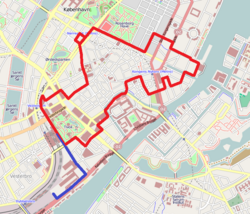
The network is divided into several key lines: the M1 (13.7 km) and M2 (14.2 km) serve Amager, with the M2 providing a vital link to Copenhagen Airport. The M3 (City Circle Line or Cityringen) opened in 2019 to enhance city center connectivity, while the M4 expanded to Nordhavn in 2020 and Sydhavn in 2024. Looking forward, the M5 line is expected to open in two stages (2036 and 2045) to serve Refshaleøen and the artificial island of Lynetteholm.
Rail Networks: S-trains and Regional Services
The S-train (S-tog)
The S-train is a metrolike rapid transit network that connects the city center with the outer boroughs. With 170 km of dual track and 84 stations, it operates on tracks fully separated from other traffic. Most lines run six trains per hour, though frequency increases to every two or three minutes in the central section (the Boulevard Line). The Ringbanen line offers a higher frequency of 12 trains per hour.
Regional and Local Trains
Regional trains handle longer distances within the Metropolitan Area and beyond. Key routes include the Kystbanen (Coast line) to Helsingør and services to Roskilde and Copenhagen Airport. The Øresundståg extends this reach into Scania and other Swedish provinces. Additionally, three local train systems operate on unelectrified tracks in the northern and southernmost suburbs, often integrating with the R-net (a network of regional trains and bus trunk routes).
The Bus System and BRT
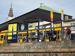
Managed by the regional agency Movia, Copenhagen's bus network is categorized by service type and color coding to help passengers identify the best route for their needs.
- A-buses (Red): High-frequency trunk routes (7.5 minutes or better) with 24/7 operation in the city and all-door boarding.
- C-buses/Cityline (Turquoise): High-priority routes with 4-minute frequencies. The 5C is the city's busiest line, carrying over 17 million passengers annually as of 2019.
- S-buses (Blue): Fast rapid routes with limited stops, running every 15 minutes.
- Other Services: These include E-buses (Express), R-buses (Rural), and N-buses (Night services).
Bus Rapid Transit (BRT) Developments
Copenhagen is evolving its bus infrastructure through BRT (Bus Rapid Transit), which utilizes dedicated lanes and signal priority to increase speed. The "Den Kvikke vej" (The Smart street) is an existing 2.5 km busway. Future projects include upgrading the 200S and 400S lines to full BRT by 2026, which is expected to reduce travel time on the 400S by 15 minutes between Lyngby and Ishøj.
Ticketing and Fare Zones
The city uses a unified ticketing system divided into 95 zones, with Zones 1, 2, and 3 forming the city core. A single ticket is valid across all modes of transport. For tourists, the City Pass covers zones 1-4 and is available for 24, 48, 72, or 120 hours.
The Rejsekort (Travel Card) is an electronic system similar to London's Oyster card. It calculates fares based on the distance "as the crow flies" between the check-in and check-out points, aiming for a more accurate correlation between price and distance traveled.
| Station Type | Number of Stations |
|---|---|
| Metro only | 30 |
| S-train only | 21 |
| Regional train only | 1 |
| Metro and S-train | 4 |
| S-train and Regional train | 3 |
| Metro and Regional train | 2 |
| Metro, S-train, and Regional train | 3 |
| Total | 64 |
Domestic and International Connectivity
Copenhagen Central Station serves as the primary hub for Intercity and Express trains across Denmark, connecting the capital to major cities like Aarhus, Odense, and Aalborg. International travelers can access direct trains to Stockholm, Hamburg, and Berlin, while services to southern and western Sweden depart every 20 minutes.
For intercity bus travel, the new Copenhagen Bus Terminal, opened on June 6, 2024, now serves as the central point for national and international bus services.
Frequently Asked Questions
What is the Rejsekort and how does it work?
The Rejsekort is an electronic travel card used for all public transport in Denmark. Instead of buying zone-based tickets, users check in and out, and the fare is calculated based on the distance traveled as the crow flies.
Which is the busiest bus line in Copenhagen?
The 5C Cityline is the busiest route in the city, recording 17,777,741 annual passengers in 2019.
How do I travel to Copenhagen Airport?
The airport is easily accessible via the M2 Metro line and various regional train services.
What happens if I travel without a valid ticket?
The fine for not possessing a valid ticket when using public transportation in Copenhagen is 750 DKK.
Are there water-based transport options?
Yes, the Copenhagen Harbour Buses operate four lines with ten stops, transporting passengers between Sluseholmen in the south and Holmen in the north.