
Mars Reconnaissance Orbiter: Advanced Instruments and Scientific Capabilities
The Mars Reconnaissance Orbiter (MRO) serves as a sophisticated orbital laboratory, utilizing a diverse suite of instruments to map the Red Planet's surface, atmosphere, and internal structure. By combining high-resolution imaging, spectroscopy, and radar, the MRO provides critical data that helps scientists understand the Martian environment and identify potential landing sites for future missions. The orbiter is highly productive, capturing approximately 29,000 images every year.
Key Facts
- HiRISE is the largest reflecting telescope ever sent on a deep space mission, achieving a resolution of 0.3 meters.
- CTX has mapped over 99% of the Martian surface as of March 2017.
- SHARAD can penetrate the Martian surface to a depth of 3 kilometers to detect ice and rock layers.
- MARCI provides a weekly global weather report for Mars using a 180-degree fisheye lens.
- CRISM was used to identify minerals like phyllosilicates and carbonates before its shutdown in April 2023.
High-Resolution Surface Imaging
HiRISE (High Resolution Imaging Science Experiment)
HiRISE is a 0.5-meter reflecting telescope capable of capturing images with a resolution of 1 microradian. From an altitude of 300 km, it can resolve features as small as 0.3 meters, surpassing the typical 0.5-meter resolution of Earth-observing satellites. The camera captures data in three color bands: blue-green (400 to 600 nm), red (550 to 850 nm), and near infrared (800 to 1,000 nm).
The instrument produces massive data files; red images are 20,264 pixels wide, while blue-green and near-infrared images are 4,048 pixels wide. Due to a 28 Gb memory limit, nominal maximum sizes are 800 megapixels for red and 160 megapixels for other bands. To manage this, 16.4 Gb images are compressed to 5 Gb before transmission. HiRISE also creates stereo pairs to calculate topography with an accuracy of 0.25 meters.
CTX (Context Camera)
The Context Camera provides the "big picture" for the orbiter. It captures grayscale images (500 to 800 nm) with a resolution of up to 6 meters. Using a 350 mm focal length Maksutov Cassegrain telescope, CTX creates context maps that guide the targeted observations of HiRISE and CRISM. It is also used for creating large mosaics and monitoring surface changes over time.
MARCI (Mars Color Imager)
MARCI is a wide-angle camera that views Mars in five visible and two ultraviolet bands. Using a 180-degree fisheye lens, it collects about 84 images daily to produce global maps with resolutions between 1 and 10 km. This allows scientists to track seasonal variations, water vapor, and ozone in the atmosphere.
![An image of Phobos taken by HiRISE on March 23, 2008, from a distance of around 6,800 kilometres (4,200 mi)[88]](/images/8a/ad/8aad5c4e4b056df6e75d7359bad5ec00b1e239608831e641cfd232a90a04fbd0.jpg)
Atmospheric and Mineralogical Analysis
CRISM (Compact Reconnaissance Imaging Spectrometer for Mars)
CRISM is a spectrometer—an instrument that measures the spectrum of light to identify materials—operating from 362 to 3920 nm. It identifies minerals and chemicals, such as iron oxides, phyllosilicates, and carbonates, which indicate the past or present existence of water. The instrument operated until April 3, 2023.
MCS (Mars Climate Sounder)
The Mars Climate Sounder is a radiometer that measures vertical variations in the atmosphere. By analyzing the horizon in 5 km increments, it generates daily global weather maps detailing temperature, pressure, humidity, and dust density. It has provided evidence of carbon dioxide snow and helped categorize Martian dust storms.
Subsurface Exploration
SHARAD (Shallow Radar)
SHARAD uses HF radio waves (15 to 25 MHz) to probe the internal structure of the Martian polar ice caps and underground layers of regolith (loose surface material), rock, and ice. It can resolve layers as thin as 7 meters up to a depth of 3 km. This instrument complements the MARSIS instrument on the Mars Express mission.
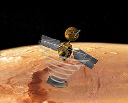
Engineering Instruments and Science Experiments
Beyond its primary science tools, the MRO carries several engineering systems that double as research tools:
- Electra: A UHF software-defined radio used for relaying data between Mars landers/rovers (such as Curiosity and Phoenix) and Earth. It also provides Doppler data to determine the precise location of surface vehicles.
- Ka band Telecommunications Experiment Package: Used during the cruise phase to test low-power communication with Earth.
- Optical Navigation Camera: Images the moons Phobos and Deimos to determine the orbiter's orbit. It was reactivated in 2022 for the Mars Sample Return mission.
- Gravity Field Investigation Package: Measured gravitational variations via Doppler shifts in radio signals to study subsurface geology and atmospheric density (ended in 2022).
- Atmospheric Structure Investigation: Used accelerometers during aerobraking (using atmospheric drag to slow down) to study atmospheric density and wind variations.
Instrument Summary Table
| Instrument | Primary Function | Key Specification | Target/Focus |
|---|---|---|---|
| HiRISE | High-res imaging | 0.3 m resolution | Surface topography & detail |
| CTX | Context imaging | 6 m resolution | Large-scale mapping |
| MARCI | Global imaging | 1-10 km resolution | Weather & atmosphere |
| CRISM | Spectroscopy | 18 m resolution | Mineralogy & water markers |
| MCS | Radiometry | 5 km vertical slices | Atmospheric profiles |
| SHARAD | Radar sounding | Up to 3 km depth | Subsurface ice & rock |
Frequently Asked Questions
What is the highest resolution image the MRO can take?
The HiRISE camera can achieve a resolution of 0.3 meters (1 foot) from an altitude of 300 km.
How does SHARAD differ from other radar instruments?
SHARAD focuses on higher resolution for shallower depths (up to 3 km), whereas the MARSIS instrument on Mars Express has coarser resolution but can penetrate much deeper into the planet.
What minerals was CRISM searching for?
CRISM looked for minerals indicative of water, specifically iron oxides, phyllosilicates, and carbonates.
How does the MRO help rovers on the surface?
The Electra communications package acts as a relay, sending data from landers and rovers back to Earth, and uses Doppler data to pinpoint the surface location of these vehicles.
What is the purpose of the Optical Navigation Camera?
It images the Martian moons, Phobos and Deimos, against stars to precisely determine the orbiter's orbit and test technology for future landing missions.