
SD 44: A Comprehensive Route Guide Across South Dakota
SD 44 is a primary state highway that traverses the diverse landscapes of South Dakota, stretching from the rugged terrain of the Black Hills in the west to the fertile plains of the east. This route serves as a vital artery, connecting major national parks, indigenous lands, and several key municipalities across the state.
Key Facts
- Western Terminus: Junction with US 385.
- Eastern Terminus: Diamond interchange at I-29.
- Major Landmarks: Black Hills National Forest, Badlands National Park, and the Missouri River.
- Key Cities: Rapid City, Interior, White River, Winner, and Lennox.
- Major Intersections: US 16, US 18, US 83, and US 281.
Traversing the West: Black Hills and Rapid City
The journey of SD 44 begins at a junction with US 385, where it winds through the Black Hills National Forest. The road follows a southeasterly path, exiting and re-entering the forest boundaries before arriving in Rapid City. Within the city limits, the highway is known as Jackson Boulevard.
As it navigates the western outskirts of Rapid City, the route passes north of Canyon Lake and crosses Rapid Creek. The highway then turns north onto Mountain View Road, crossing Main Street (which carries the Interstate 90 Business designation). From there, it turns east onto Omaha Street, expanding into a four-lane highway that intersects with US 16 and the southern terminus of I-190.
After a brief concurrency with US 16, SD 44 continues southeast along Omaha Street, crossing the Dakota, Minnesota and Eastern Railroad. As it exits the city and enters unincorporated Rapid Valley, the road narrows to two lanes and parallels a state-owned railroad, passing just south of the Rapid City Regional Airport.
The Badlands and Pine Ridge Indian Reservation
Leaving the Rapid City area, SD 44 passes through the community of Caputa and crosses Rapid Creek for the final time before crossing the Cheyenne River. This transition marks the entry into Badlands National Park, where the road winds through characteristic hills and plateaus, moving from Pennington County into Jackson County.
In the town of Interior, the highway meets the southern terminus of SD 377. Continuing east and then south, SD 44 exits the national park and enters the Pine Ridge Indian Reservation by crossing the White River.
The route travels south through the reservation before turning east through Wanblee and intersecting SD 73. Upon crossing into Mellette County, the highway leaves the reservation and meets SD 63 shortly after the county line.
Central South Dakota: From White River to Winner
SD 44 crosses the Little White River before reaching the city of White River, the county seat of Mellette County. Here, it runs south concurrently with US 83 for approximately two miles (3.2 km) before splitting east toward the town of Wood.
East of Wood, SD 44 joins SD 53. Together, they enter Tripp County, forming the northern limit of Witten. The two routes then intersect US 183, and all three travel south for about four miles (6.4 km) until they meet US 18. At this junction, SD 53 splits west, while SD 44 continues east alongside US 18 and US 183 toward the city of Winner.
Crossing the Missouri River and the Eastern Plains
After leaving Winner, SD 44 intersects SD 49 and enters Gregory County. It then meets SD 47 and begins a more winding descent toward the Missouri River and Lake Francis Case. After intersecting SD 1806, the highway crosses the river into Charles Mix County.
East of the Missouri River, the terrain flattens significantly. SD 44 runs concurrently with SD 50, passing SD 1804 and entering the city of Platte, where it meets the southern terminus of SD 45. The concurrency with SD 50 ends at the Douglas county line.
In Douglas County, the highway travels east for 15 miles (24 km) to a junction with US 281 south of Corsica. Following a three-mile (4.8 km) concurrency with US 281, SD 44 continues east for another 12 miles (19 km) into Hutchinson County, where it reaches Parkston and intersects SD 37.
The Final Stretch to I-29
Continuing east from Parkston, SD 44 crosses the James River and US 81 before entering Turner County. The route crosses the BNSF Railway and the west fork of the Vermillion River to enter the town of Parker.
In Parker, SD 44 overlaps with SD 19.
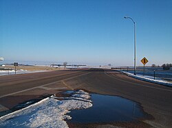
The two highways travel southeast together before SD 19 heads south and SD 44 turns east, crossing the east fork of the Vermillion River. The road passes through Chancellor and enters Lincoln County, heading toward Lennox.
In Lennox, SD 44 meets the southern terminus of SD 17, turns south for one mile (1.6 km), and then turns east. The highway concludes its journey after 4.5 miles (7.2 km) of rural travel, ending at a diamond interchange with I-29.
Route Summary Table
| Region/City | Key Intersection/Landmark | County |
|---|---|---|
| Black Hills | US 385 (Western Terminus) | Pennington |
| Rapid City | US 16 / I-190 | Pennington |
| Badlands NP | SD 377 (Interior) | Jackson |
| Pine Ridge | SD 73 / SD 63 | Oglala Lakota / Mellette |
| White River | US 83 | Mellette |
| Winner | US 18 / US 183 | Tripp |
| Platte | SD 50 / SD 45 | Charles Mix |
| Parker | SD 19 | Turner |
| Lennox | SD 17 | Lincoln |
| Eastern Terminus | I-29 | Lincoln |
Frequently Asked Questions
Where does SD 44 begin and end?
SD 44 begins at a junction with US 385 in the west and terminates at a diamond interchange with I-29 in the east.
Which national parks does SD 44 pass through?
The highway passes through both the Black Hills National Forest and Badlands National Park.
Does SD 44 cross any major rivers?
Yes, the route crosses Rapid Creek (multiple times), the Cheyenne River, the White River, the Little White River, the Missouri River, the James River, and the Vermillion River.
What is the name of SD 44 within Rapid City?
Within Rapid City, the highway is known as Jackson Boulevard.
Which other US highways share a concurrency with SD 44?
SD 44 shares concurrent sections with US 16, US 83, US 18, US 183, and US 281.