
St Peter Port Harbour Facilities and Maritime Infrastructure
St Peter Port serves as a vital maritime hub, blending centuries of historical engineering with modern logistics to support freight, passengers, and a thriving tourism industry. From its origins as a simple mole to becoming the largest marina in the British Isles, the harbour is a sophisticated network of piers and berths designed to handle everything from local fishing boats to massive international cruise liners.
Key Facts
- Largest Marina: St Peter Port marina is the largest in the British Isles, welcoming over 10,500 visiting yachts annually.
- Cruise Hub: It is Europe's largest tender port for cruise liners, hosting over 100 ships between April and October.
- Passenger Volume: The harbour facilitates the arrival of more than 100,000 cruise visitors every year.
- Infrastructure: Features specialized ro-ro (roll-on/roll-off) ramps for vehicles and lo-lo (lift-on/lift-off) facilities for containers.
Freight and Passenger Services
The harbour is equipped to handle a diverse range of maritime traffic. A dedicated passenger terminal and customs facilities are located on St Julian's Pier to streamline the arrival and departure of travelers.
For vehicle and freight transport, the harbour utilizes two ro-ro ramps. These accommodate various vessels, including the 97m long Voyager catamaran and traditional ferries like the Islander. Freight operations are further supported by two large cranes and several smaller units used for loading and unloading containers.
| Operator | Vessel Type | Destinations |
|---|---|---|
| Brittany Ferries | High speed Catamaran | Saint Malo, Jersey (Limited), Poole |
| Brittany Ferries | Ferry | Saint Malo (Limited), Portsmouth |
| Travel Trident | Herm Ferry | Herm |
| Isle of Sark Shipping | Sark Ferry | Sark |
| Islands Unlimited | High speed passenger Catamaran | Jersey |
| Alderney Ferry Services | High speed passenger Catamaran | Alderney |
The Historic Piers
Albert Pier
The Albert Pier marks the southern arm of the original harbour. Its history dates back to 1275, when Edward I of England noted the need for reconstruction of the original mole (a massive stone breakwater). By 1580, a dry stone pier was completed, standing 35 ft high and 360 ft long. Until 1806, a roundhouse tower served as a holding cell for prisoners bound for Castle Cornet. The pier was renamed in honor of Prince Albert following his death in 1861, and a statue of the Prince was erected in 1863.
North or Crown Pier
The northern arm, known as the North or Crown Pier, began as a breakwater in 1703. By 1750, it was completed as a dry construction. Historically, the harbour quay was not finished until the late 1770s; prior to this, all goods were landed on the beach, and cattle were required to swim ashore. The pier entrance was widened in 1838 and the pier was rebuilt to a length of 220 ft in 1893.
St Julian's Pier
Construction of St Julian's Pier began in 1853. It has evolved into a critical logistics zone, featuring a weighbridge (upgraded to 20-ton capacity in 1923), the Cambridge Berth (1909), the Inter-Island Quay, and the ro-ro ramps installed in 1975. The pier terminates at the White Rock Pier, which houses lo-lo facilities.
Castle Pier
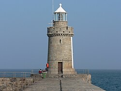
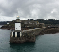
Built in the 1850s to protect the expanded harbour, the Castle Pier connects the south esplanade to Castle Cornet. Key features include the Fish Quay, a connecting bridge to the castle, and the Castle Breakwater, which was completed in 1861 with a lighthouse added in 1868. During World War I, the pier hosted a French seaplane base.
Between 1931 and 1951, the Albert dock was used for oil imports. In 1942, German forces constructed tunnels at La Vallette to store fuel containers; these tunnels now serve as a museum.
Specialized Maritime Facilities
Fishing and Local Yachting
The Fish Quay, a purpose-built facility completed in 1987, uses a reinforced concrete deck on piles with pontoons to support local fishing boats. For leisure craft, the harbour provides two dedicated marinas: the original Albert Marina (1975) and the Queen Elizabeth II Marina, which opened in 1989.
Visiting Yachts and Cruise Ships
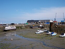
Visiting yachts can utilize pontoons in the inner harbour—which uses a fixed barrier to retain water during low tide—or moor at deep water pontoons in the outer harbour.
Due to the restricted size of the harbour, cruise ships cannot enter and must anchor in the roads. Passengers are transported via tenders. While disembarkation previously occurred at White Rock pier, a new pontoon and ramp were installed at Albert Pier. To address early complaints regarding the steepness of the ramp during low tides, a longer ramp with a reduced gradient was installed in 2015.
Frequently Asked Questions
Why can't cruise ships dock directly in the harbour?
The restricted size of the harbour prevents large cruise ships from entering, requiring them to anchor in the roads and use tenders to transport passengers to shore.
What is the largest marina in the British Isles?
The St Peter Port marina holds this title, hosting more than 10,500 visiting yachts every year.
What are ro-ro and lo-lo facilities?
Ro-ro (roll-on/roll-off) ramps allow vehicles like cars and lorries to drive directly on and off ferries. Lo-lo (lift-on/lift-off) facilities use cranes to lift containers on and off ships.
What is the historical significance of the tunnels at La Vallette?
Built by the Germans in 1942 to house fuel containers during the occupation, these tunnels have since been converted into a museum.
How has the cruise ship disembarkation process improved?
In 2015, a longer ramp was installed at the Albert Pier to reduce the gradient, making it easier for passengers to climb during very low tides.